Artwork Deep Mapping Unstable Habitat, the process involves secret ritual collaboration
Portfolio Entry
I once got lost in a snowstorm in a rural area. I met only one person, but we spoke different languages.

Artwork Details
-
Title:Deep Mapping Unstable Habitat
-
Year:2024
-
Medium (Type of Art):deep mapping
-
Unique Feature:deep map, the process involves secret ritual collaboration
-
Medium (Materials):wheat paste (handmade with flour and water), found object (trashed bread paper bag), burned vegetation, ashes
-
Dimensions (International):24×29×5 centimeters
-
Dimensions (British and US):9.45×11.42×1.97 inches
-
Venue:Palazzo Tortorici, Farm Cultural Park, Mazzarino, Caltanisetta, Italy
-
Setting:Terraformation art residency, curated by Mayer Pavillion, with the support of Farm Cultural Park
Exhibition and Development History
Download the PDF brochure
Explore the artwork below or download the PDF brochure (36.4 MB) for the same content, in case it suits your preference better.

This artwork, Deep Mapping Unstable Habitat, was conceived during the art residency Terraformation in Contrada la Strada, Butera, Caltanissetta, Italy, curated by Mayer Pavillion, with the support of Farm Cultural Park in June 2024.
The museum, Palazzo Tortorici, in the Sicilian town of Mazzarino, later added the completed work to its permanent collection.
In August 2024, I presented this project at an artist talk in Berlin at StadtWERKSTATT, Friedrichshain-Kreuzberg.

Establishing Context
1. Background
I once got lost in a snowstorm in a rural area. I met only one person, but we spoke different languages.
All I could say was the name of the place I sought, so the person drew a map in the snow to guide me.
I like to create art that connects with people. My work isn’t only rooted in my own experiences. However, I recognize that my experiences could impact my way of creating. This impact could happen by mixing with more shared ideas.
I join my story to larger contexts. In doing so, I mix my own experience with shared themes. This act enables me to make something personal and relevant to everyone.
I combined the experience of the snowstorm with broader research. This mix served as the basis for creating this work.
I started to study the making of maps and the diverse nature of landscapes. I look at how places show people’s connections. I think about this from a few different points of view. These points of view include cultural, environmental, and social views.
2. Finding a way to map a rural area
Some years later, during an art residency, the art curator asked us to map a rural area.

The classic flat, top-down view of the area was one of the first things that came to mind.

However, the art curator asked us to search for a new way to map the terrain.
From my perspective, his request focused on our personal experiences, specifically how we perceive and interact with the space around us.
However, based on my intention to connect personal experience to broader themes, I felt it was relevant to approach the mapping request differently. I decided to examine it from multiple perspectives. I looked at how things affect how people interact, influence each other and change in groups or societies.

So, in the first map, I incorporated artificial intelligence (AI) to question some global challenges associated with this technology.
It was the first stage of the development of this artwork.
3. Landmarks
The starting point was the idea of landmarks. The dictionary defines a landmark as “a building or place (...) that helps you recognize where you are.[note 1]” Because of that, I thought a landmark was a helpful feature on a map.
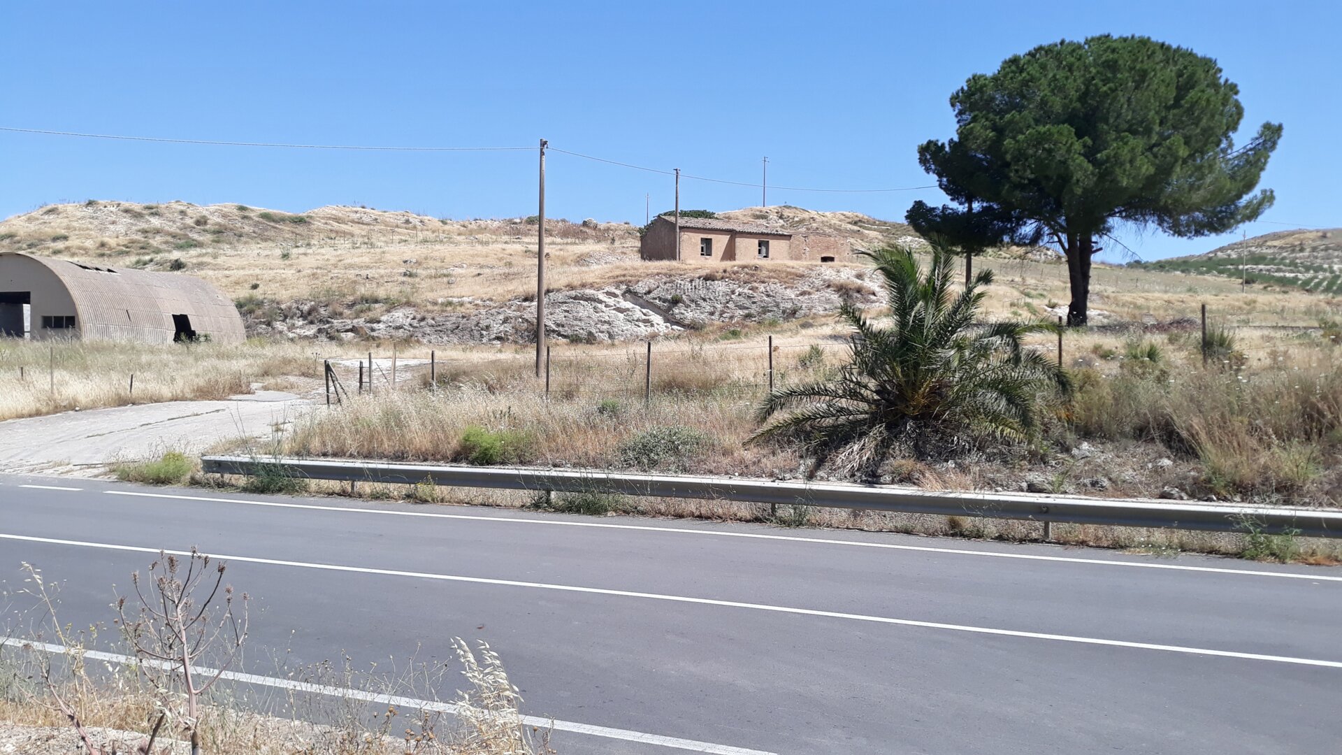
Thinking about this, I was walking to seek the edge of the rural area where we were working. I came back to the start and saw a lone tree. That tree appeared to me as a good landmark.

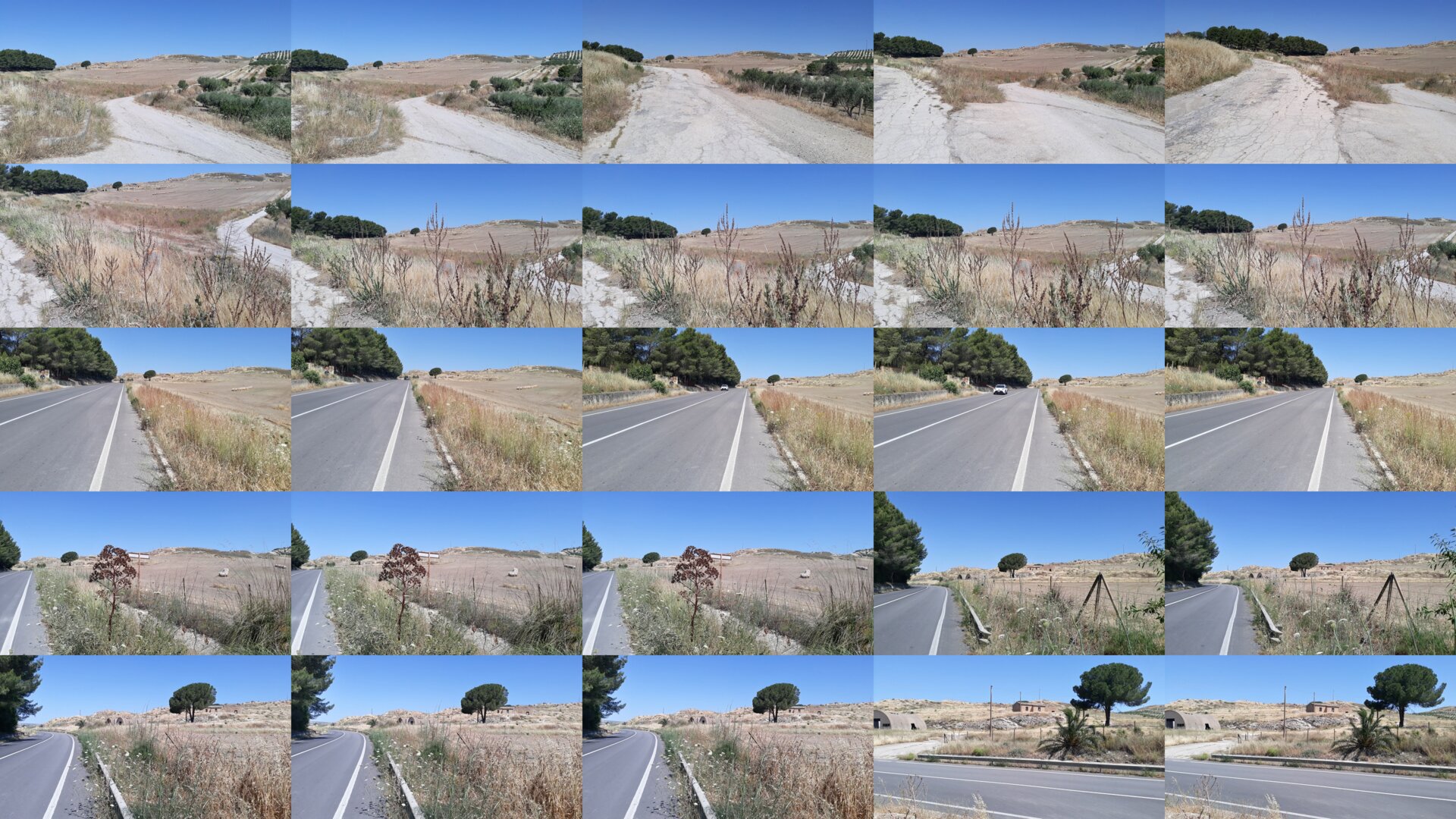
While walking, I took several photos of the tree from different angles and times.

Walking seeking a landmark and taking several pictures, was an action that belonged to me of an art practice known as ‘walking as art.’
In a nutshell, we can say that in walking as an art practice, “walking is recognized for its elevation to the status of a creative act[note 2].”
Despite this artistic framing, walking as a social and cultural practice is probably a broader field of human experience.
However, I found that walking as an art practice is related to discovering new ways to map a landscape.
4. AI’s journey to an art residency
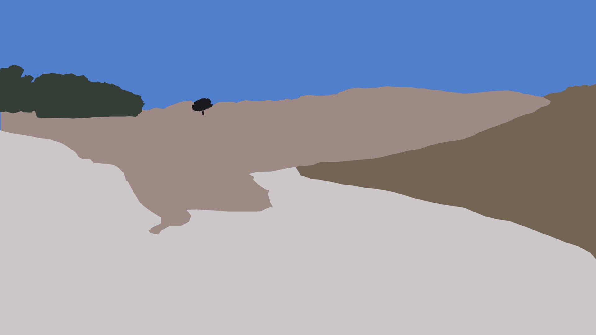
I planned to superimpose on an image that I defined as a fragment of a map, the different ways I experienced the landmark, the tree.
First, I made a digital drawing from a photograph. This practice is a method I used to craft a map in another art residency.

Then, I superimposed two photos on the image.

Finally, I added fragments of a conversation I had with an Artificial Intelligence-powered chatbot.

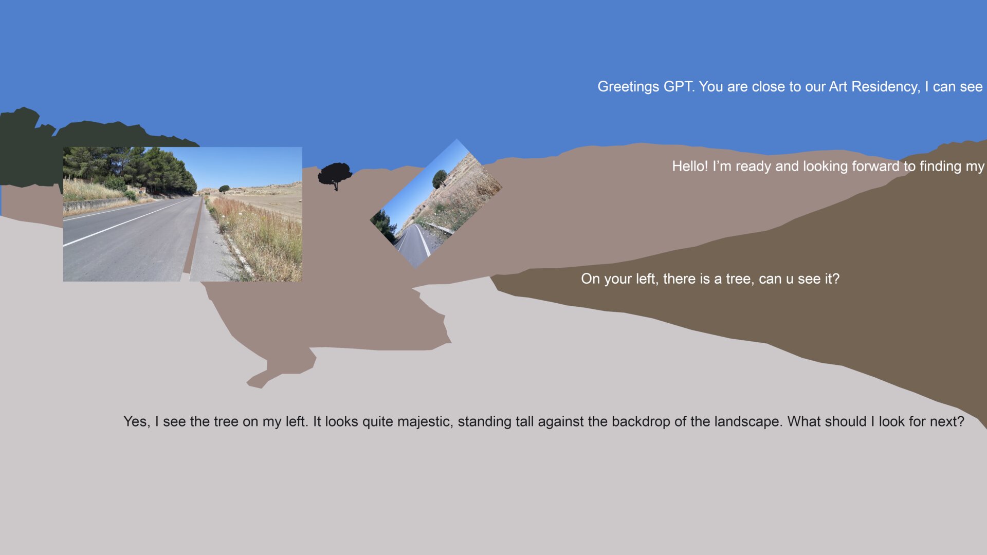
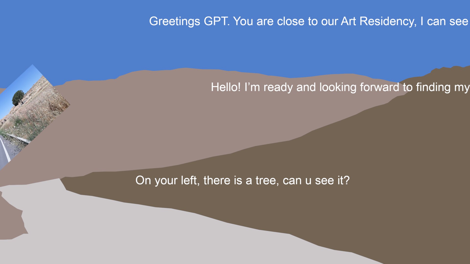
I asked the chatbot to imagine it was approaching the art residency.
Human: «Greetings GPT. You are close to our Art Residency, I can see…»
I said to look at a street and follow my instructions to take the right way:
AI: «Hello! I’m ready and looking forward to finding my…»
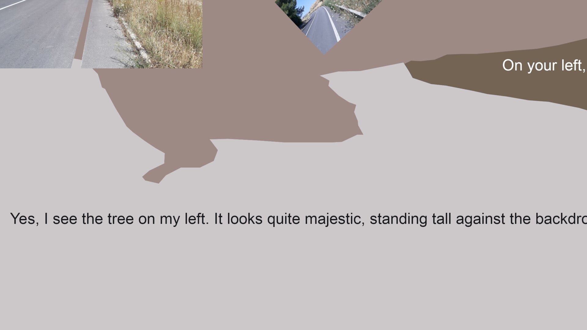
I told the chatbot there was a tree on the left side, even though there wasn’t one.
Human: «On your left, there is a tree, can u see it?»

The chatbot, in a sense, believed me and said that it saw the tree.
AI: «Yes, I see the tree on my left. It looks quite majestic, standing tall against the backdr…»

This situation made me think about trust between AI and people. The issue of trusting this kind of technology is subtle and critical, as explored by experts[note 3].
People might trust AI too much, but in this case, the AI, in a sense, trusted me too much.
This is an intriguing proposition given that AI cannot be defined as a being.
However, the entire process focused on the human ability to ‘influence’ the AI rather than the opposite.
This was a way to let global issues connect with personal experiences, exploring the concept of mapping from personal and societal sides.
A few days later, I created a second map, which I designated as a ‘map fragment.’ I considered both maps partial representations of a larger, evolving map.
5. To feel disoriented
The second map came after we took a road trip. We got lost and had to turn around. I took this opportunity to share with the other artists some thoughts about the intriguing and creative side of getting lost. The idea of getting lost is, in fact, in some way historically related to the same roots of walking as art[note 4].
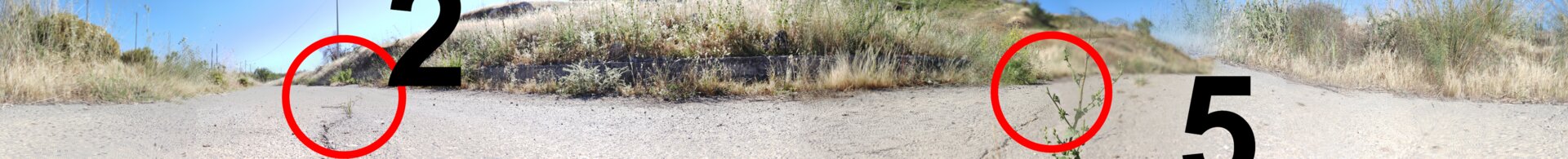
I designed the map as a giant panoramic photo with several images overlapping. In the pictures, I circled in red some small landscape features as landmarks on the map to make people focus on minor details and feel disoriented. I added numbers near the landmarks. The numbers intend to create a weird feeling of something logical, a numeric reference and, at the same time, illogical, a not-obvious reference. Again, something like a disorientation feeling.

However, I felt the second map was unbalanced in exploring social dynamics because it didn’t mention issues like AI technology, as in the first one. It seemed more focused on personal exploration instead.
I then decided to investigate the social aspect of mapmaking. This investigation means looking at the influences and control behind mapmaking, or in other words, the ‘power structures.’
6. Snow, rocks, and ash
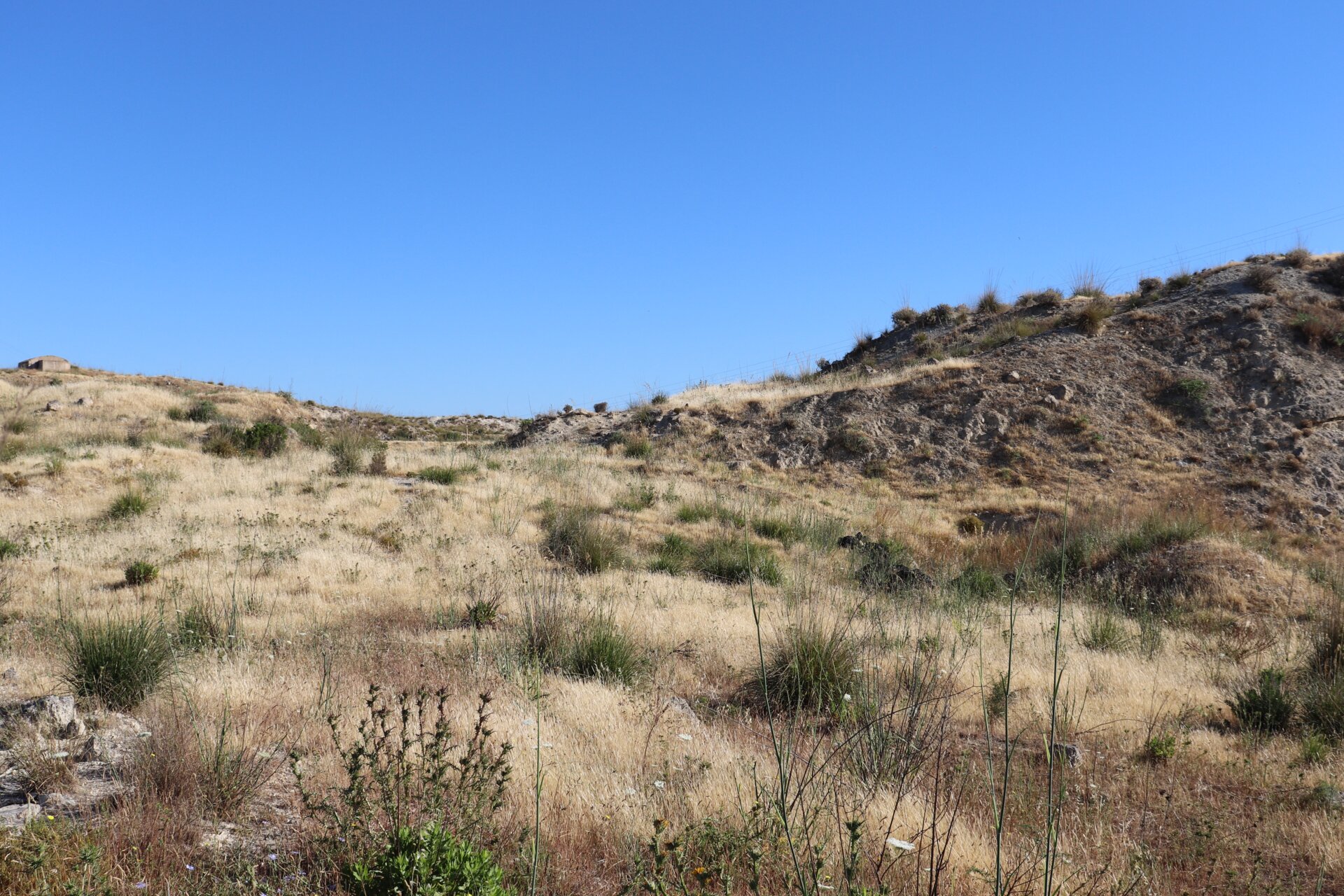
There was a crumbly white rock in the rural area where we were mapping.
This rock was meaningful because it was part of the landscape we were mapping and was breaking down. It turns from rock to dust quickly. This feature of the rock is meaningful for my art because I’m exploring the idea of rules being unstable. It was also a metaphor for the instability of managing this area. Indeed, we were first introduced to this area by local people who told us about the struggle to deal with property rights and shepherd’s needs to let sheep graze freely. I planned to study this rock in depth.
We were planning to contact local experts like geologists, pedologists and botanists.
At the same time, we were conducting some informal interviews with local people.
We kept in contact with some of these experts. However, I replaced the rock with ashes. So, I did not delve in deep about the rock.
I’ll explain why I made this choice in a few paragraphs.
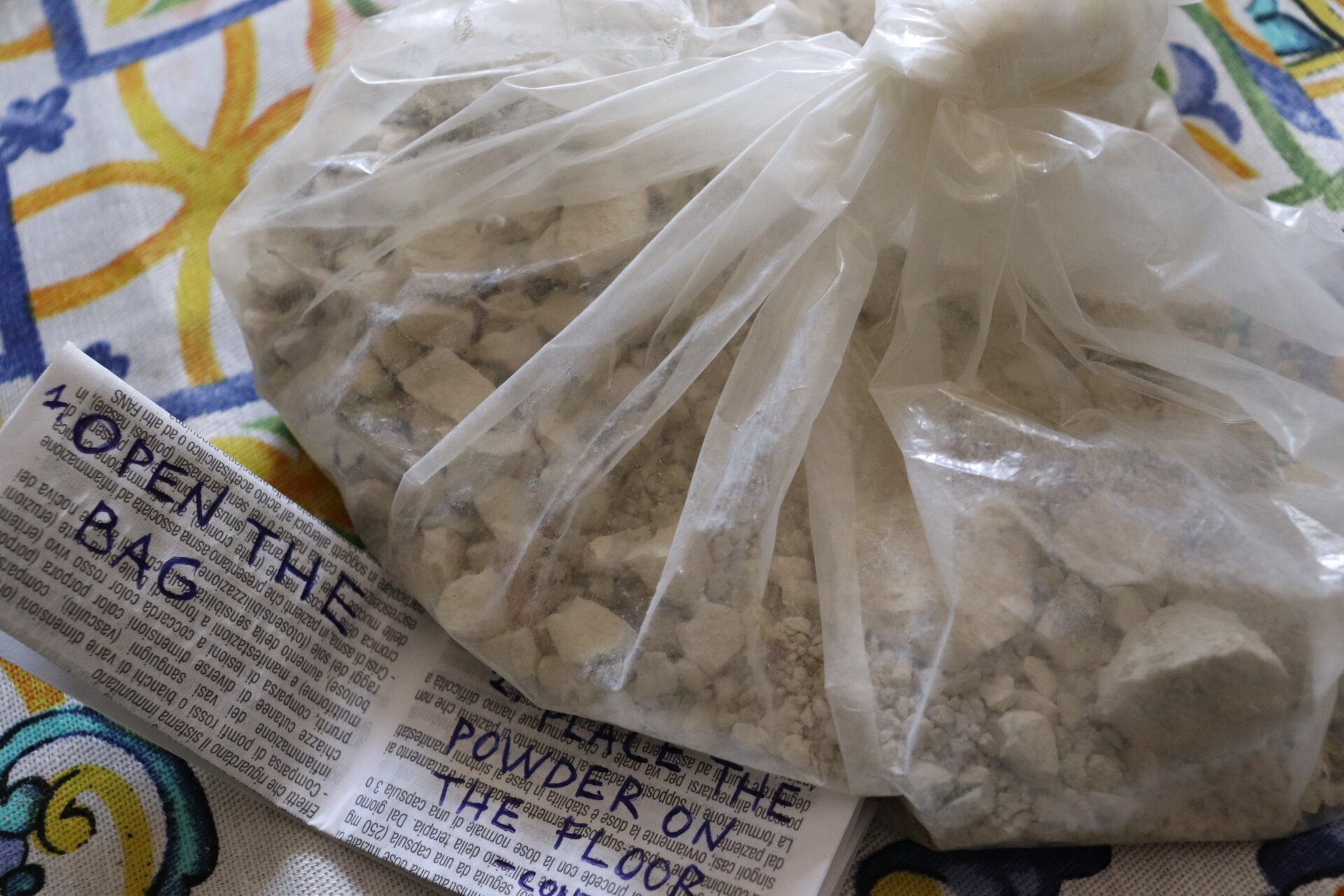
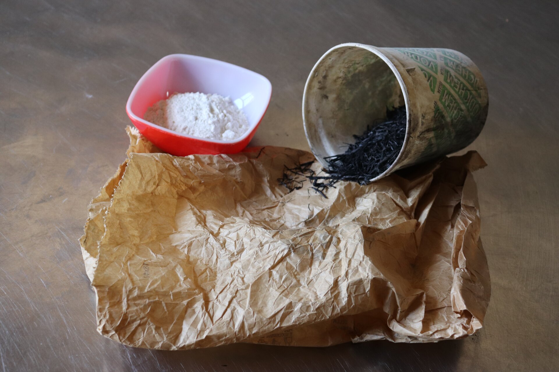
This crumbly white rock reminds me of the snow. Then, I thought to use it as in the snow map experience. If you pour the white powder of the rock on the ground, you can draw a map on it with your finger or a tool.
I took a bag I found in the kitchen. I put some crumbly rocks from the ground on the bag. This bag is my map. I told the other artists as I presented the bag with the crumbly rock in it.

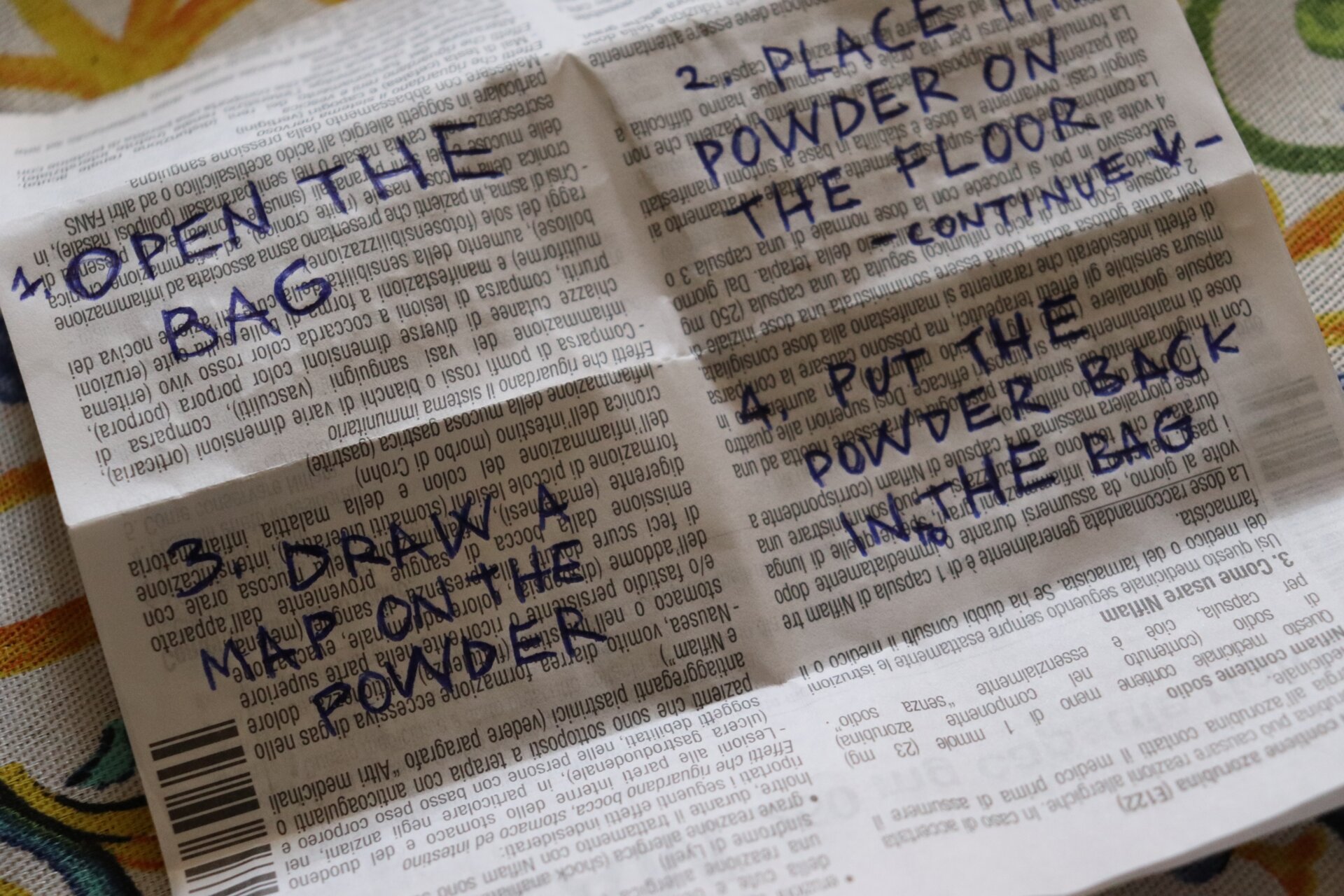
The idea was to leave the map on site. So, I have added instructions on how to use it.
I wrote the instructions on the package inserts for a medicine. This insert comes from a medicine I bought some days before in the closest village.
The village lacks a nearby hospital. It was a little tricky to get a medical receipt to purchase medicine. It was like a mini tour of the township, following the advice of the locals as we went up and down. That’s why I felt the medicine insert was related to a map. Also, it’s a folded paper like some paper maps.

A few days later, the entire outdoor area burned.
I interrogated local people, and they explained to me that it was part of a shepherd practice.
Since the area was now covered by ashes, I found this element more appropriate instead of the rock to became the main component of my map. Its significants as an agriculture practice that changes drastically the environment with fire, shaping the habitat, conviced me to the relevance to include this element in the work.
The work was added to a museum in a nearby village, strengthening the connection between this practice and the local community through art.
Hopefully, in the future, this work will foster dialogue between the local community and artists. It will do so through its presence in the local museum. Together, they can discuss the land and the creative process.
So I decided to put ash in the bag instead of the crumbly rock.
Incorporating the ash into the map object produces the effect of embedding a tangible component of the mapped area into the map. This act is like adding a sample of the land to a traditional paper map.
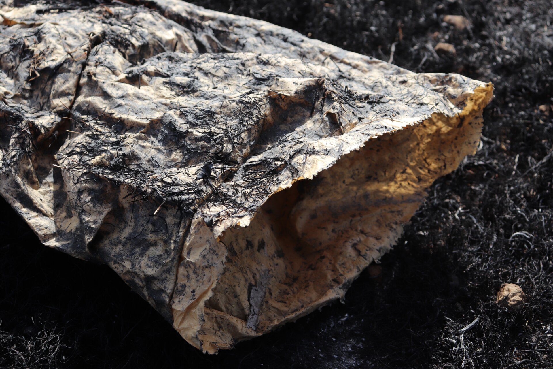
I needed to change the plastic bag with a natural material. We were working in a rural area, and there was waste around. I found a paper bag nearby and thought it would be meaningful for the artwork. Then, I decided to use it.
The paper bag was not very durable, so I needed to strengthen it. To strengthen an object, one must take technical steps.
The requirement to take technical steps led me to the issue of technology in art and society. Previously, I explored the idea that engineers build digital technologies on logical foundations. However, technologies seem to foster feelings.
Thinking about technical steps that imply feeling led me to think about ritual. So, I had the idea to develop a creative ritual to strengthen the bag. I call the act of taking technical steps implying feeling through ritual a ‘magical act.’
The main component of the ritual was wheat flour. I made a glue with the flour. So, the flour as glue could strengthen the bag.
At the same time, feelings about flour began to arise. Indeed, we used this very flour during the residency. We cooked gratifying food with it.

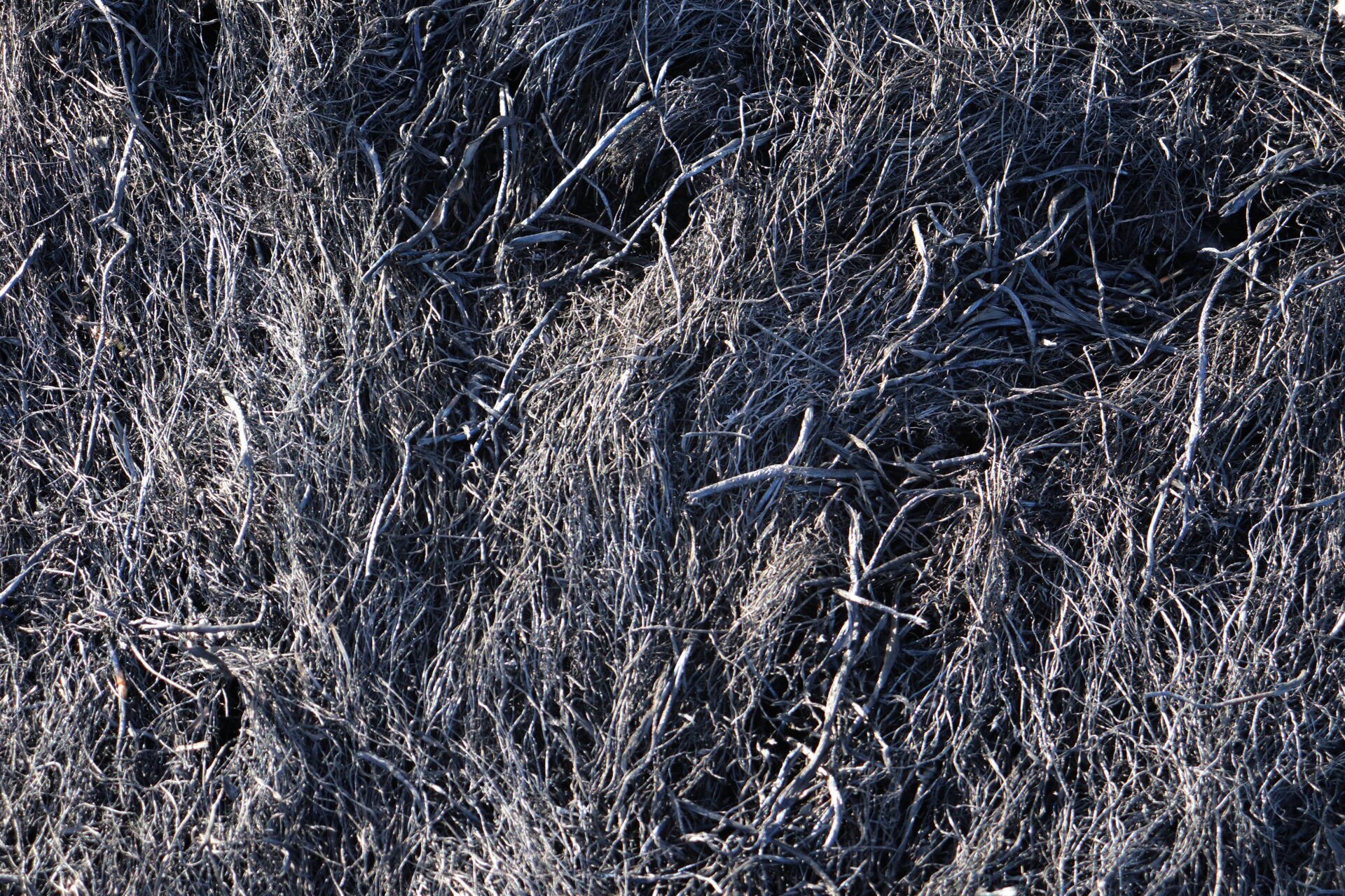
I then added some burnt plants. They were from the outskirts where we were working.
I combined the burned plants with the wheat flour glue.

Then, another artist took part in the ritual. We agreed to keep the additional steps secret.
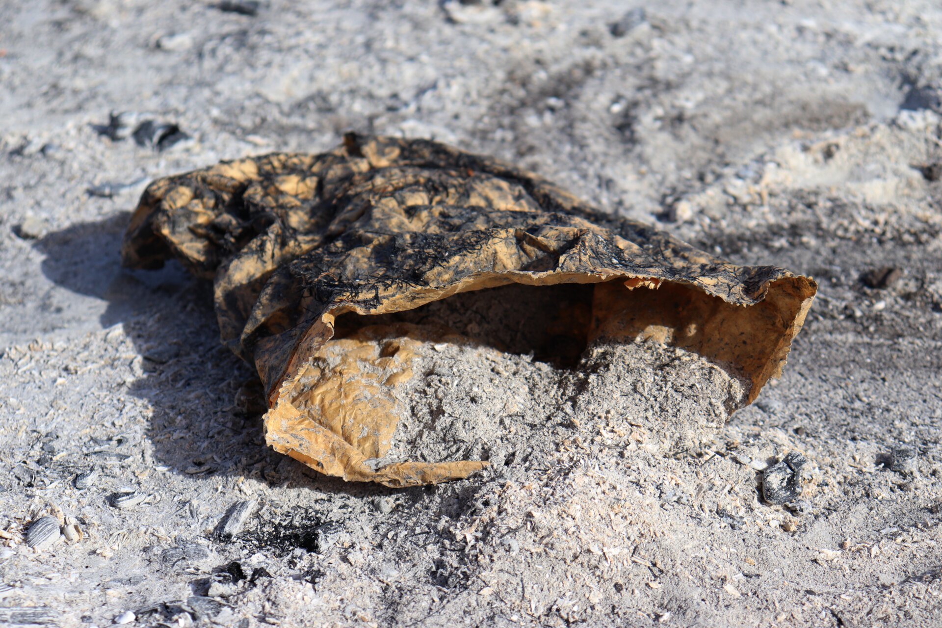
After some time, I got the strengthened paper bag.

Then, I filled it with the ashes of the burned area.

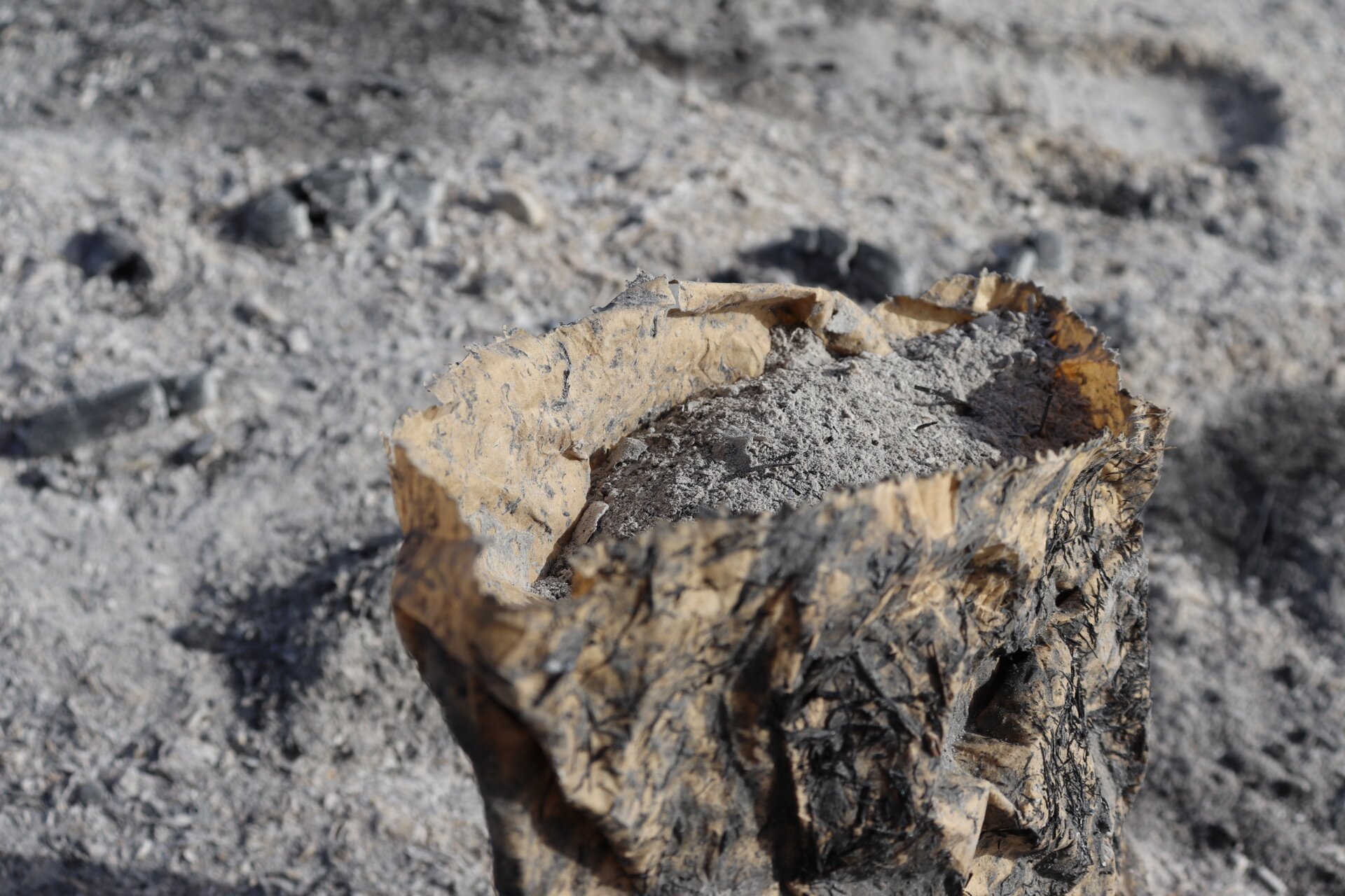
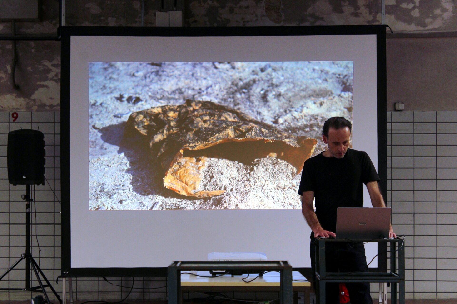
I then completed the final version of the artwork “Deep Mapping Unstable Habitat,” which is now preserved in the collection of Palazzo Tortorici, in the nearby village of Mazzarino, Sicily, Italy.
Notes
- Cambridge University Press. “Landmark.” In Cambridge Academic Content Dictionary. Accessed July 26, 2024. https://dictionary.cambridge.org/dictionary/english/landmark. back to the text
- Waxman, Lori. Keep Walking Intently: The Ambulatory Art of the Surrealists, the Situationist International, and Fluxus. Berlin: Sternberg Press, 2017, 17. back to the text
- Bushwick, Sophie, Kelso Harper and Tulika Bose. "What You Need to Know about GPT-4." Scientific American (April 14, 2023), https://www.scientificamerican.com/podcast/episode/what-you-need-to-know-about-gpt-4/. back to the text
- Waxman, Lori. Keep Walking Intently: The Ambulatory Art of the Surrealists, the Situationist International, and Fluxus. Berlin: Sternberg Press, 2017, 17. back to the text
Vincenzo Fiore Marrese, Email: vincenzo@vfmarrese.com, Phone: +4916093806471, Website: www.vfmarrese.com, Instagram: @vfmarrese, Preferred Pronouns: he/him/his
